Ocean Shores residents and property owners last week were given their first full public review of a comprehensive update to the state’s Shoreline Master Plan that establishes new designations and guidelines for development and future uses for anything on the city’s large inventory of waterfront property.
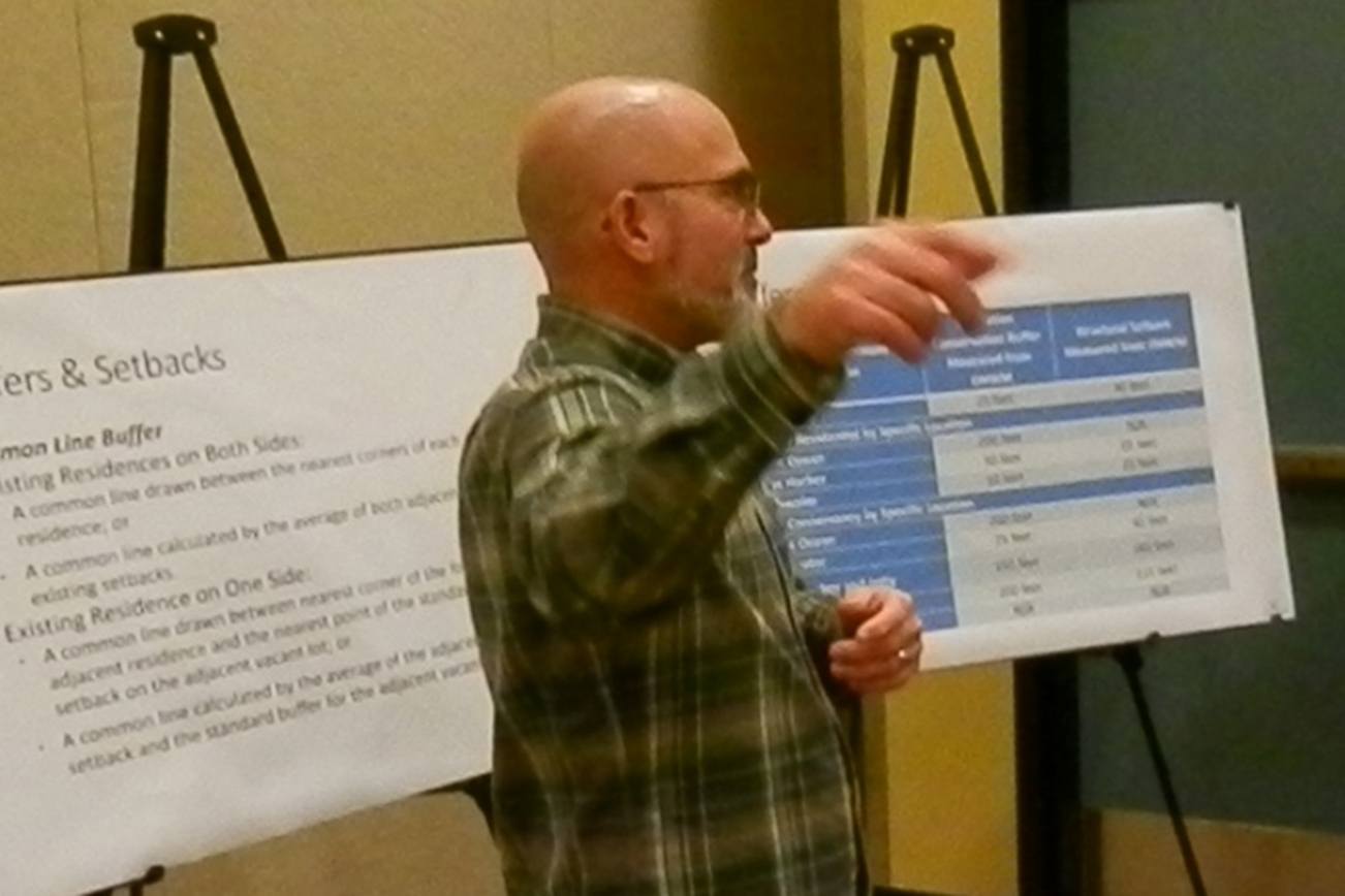
The city’s Planning Commission hosted the meeting with consultant Stan May of ABHL of Tacoma, who noted the update is to the Shoreline Management Act of 1971.
“This is the law, this is how the shoreline has to be management and regulated,” May told the crowd of about 35 people. He likened the shoreline designations to being like a zoning code “in that it regulates development.”
It applies to the ocean and Harbor, as well as lakes, rivers, streams, and dry lands extending 200 feet landward from the high-water mark. It also includes floodways and associated wetlands, May said.
The updated plan includes recommendations from the Department of Ecology and the Department of Fish and Wildlife, among other agencies. The city has to undergo the process of doing the updating, and then DOE must approve it before it goes into effect.
The changes all involve future development, May stressed.
“It is not retroactive. It doesn’t’ change anything that is already existing,” he said.
The changes, however, would affect any new construction, especially if it involved a dock or bulkhead or outbuilding.
New to the plan is the concept that there be “no net loss” of shoreline habitat in any new project that is considered, as well as a plan for restoration that will be implemented.
“We also have a requirement that we have as much public access as possible,” May said. “We have to give preference to water-dependant uses. They have first priority on any use.”
The Planning Commission’s next step will be to recommend the plan to the City Council, which then must review it and act on the document, which is available on the city’s website: Shoreline Management update
Under the designations, shorelines within Ocean Shores are listed as shoreline residential, conservation or natural areas.
The plan begin with an inventory and analysis to establish a baseline of shorelines and shoreline functions, along with existing conditions, uses and public access.
The plan, in general, has to be consistent, May said, starting with the inventory and covering what is the “reasonable and foreseeable development.”
One question, for example, was how the new SMP would potentially impact development at the Ocean Shores marina, which is owned by the Quinault Indian Nation.
The overall goal, May said, is to assure “no net loss of your shoreline functions over time.”
More stringent requirements and development regulations are going to be found in areas where there is found to be “high ecological functions,” such as the area now known as Oyhut Bay — “Where it’s a highly functioning wetland environment in the bay, that is going to have stronger regulations than in the marina,” May said.
A restoration plan also is the final piece of the shoreline update. It identifies places where work can be done “to make it better than it is today,” May said.
Jetty erosion update
One of the questions at the Shoreline Management Program session involved what the city was doing about the ongoing issue of shoreline erosion at and around the North Jetty.
Mayor Crystal Dingler was in attendance and said the Jetty Technical Committee has been meeting for 18 months on the issue, involving the Army Corps of Engineers, the city, the Port of Grays Harbor, and the state Department of Ecology.
Efforts are under way to obtain funding from the Legislature for further study and work, Dingler said.
“We want to do a project down there that we thing will eliminate a lot of the erosion,” she said. “We’ll need everybody’s support to do that.”
The city did try to put up so-called sand fences this summer to try to build up the sand in some of the eroded areas, but Dingler said the fences were taken down recently during the first severe winter storm warning of the season.
“We took the sand fencing out before this last storm because we want to put it back in during the spring when it will have a lot more effect,” Dingler said.
She noted that the rock added to bolster emergency repairs was put in by the federal Army Corps of Engineers.
“It’s causing some problems itself, but it is protecting what it is intended to protect, and that’s our infrastructure there to make sure we didn’t breach that dune.,” Dingler said when asked about the impact of the rock or erosion.
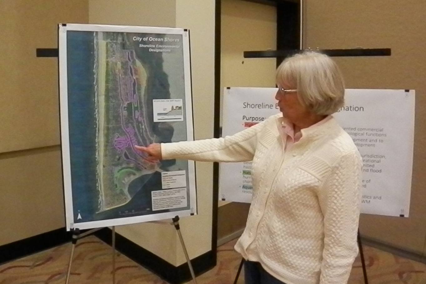
North Coast News: Planning Commission Chair Cathey Peterson shows the map of the new designations under the revised Shoreline Management Plan for Ocean Shores. North Coast News: Planning Commission Chair Cathey Peterson shows the map of the new designations under the revised Shoreline Management Plan for Ocean Shores.
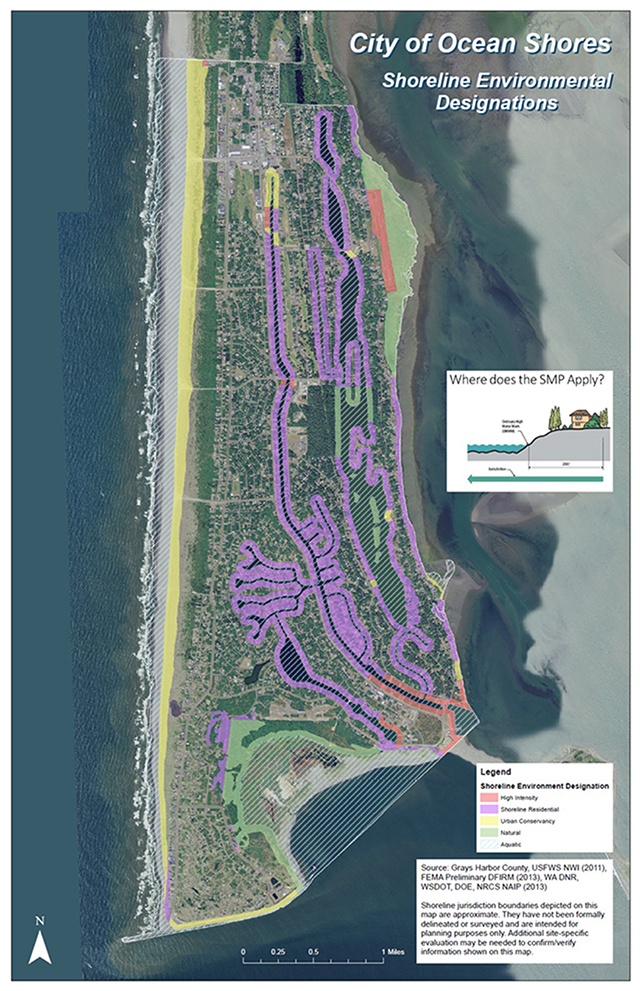
This map shows the areas impacted by the revisions to the Ocean Shores Shoreline Master Plan.