As an extraordinary area of low pressure continues to track up the coast from Oregon, forecasters are growing more confident that the weather system will bring very high winds to the Washington coast starting Friday morning.
The National Weather Service has issued a high wind warning for that will be in effect from 8 Friday morning, until 5 Friday evening, on the Washington coast, and 8 p.m. in the Willapa Hills. A high wind warning means winds of 55 to 70 mph are possible. Recreational boaters should remain in port or take shelter until winds and waves subside, the Weather Service says, and commercial vessels should prepare for very strong winds and dangerous sea conditions, and consider remaining in port or taking shelter in port until winds and waves subside.
Meterologist and University of Washington professor Cliff Mass wrote on his blog Thursday that “confidence is now very high that an unusually strong coastal storm will move northward over the Pacific Northwest coastal waters on Friday morning before it makes landfall on northern Vancouver Island.”
Mass said the Oregon coast will get the worst of it, with gusts as high as 70 mph. An extremely low pressure center is predicted to hit the Astoria, Ore., area around 11 a.m. Friday, bringing high gusts for most of the Oregon coast and the southwest Washington coast. Mass said there is a strong likelihood of power outages along the coast.
He used a number of different models to see just how unusual this low pressure event in April is. Without going into the science of it, the experienced local meteorologist says, “Bottom line: this is a unique, first time event.”
Sustained winds reaching 50 knots are expected along the central Oregon coast by 8 a.m. Friday. As the storm moves up the coast, said Mass, the winds will spread to the Washington coast. At 2 p.m., sustained winds will reach 40 knots on the southern Washington coast, and Seattle will be blustery with sustained 25-30 knot winds. Gusts could get higher, 40-50 mph, particularly near the water. The storm is suspected to last through at least midnight Friday.
According to the National Weather Service in Seattle, heavy rains will accompany the winds, with up to an inch and a half of new rainfall between Friday afternoon and Saturday morning.
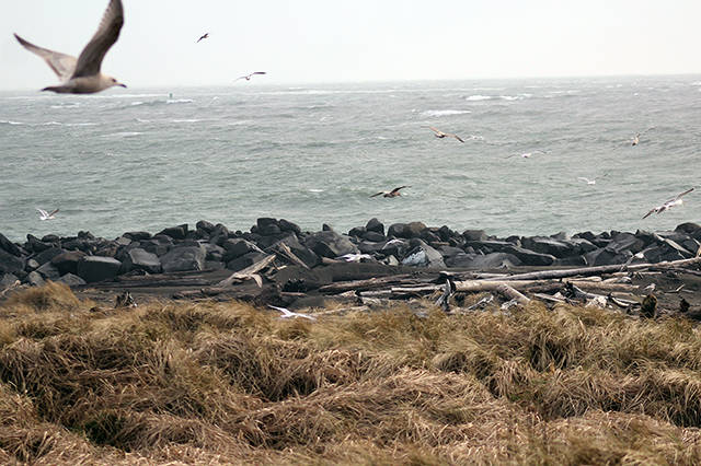
Along with strong winds and rain, Mass said the system will create substantial wave action. Forecast models show waves to 30 feet, mostly along the Oregon and extreme southwest Washington coasts. “The storm/wave watching on the coast will be impressive, but stay safe if you are there,” warned Mass.
Anyone planning to dig razor clams Friday evening at Twin Harbors should be prepared for some rough surf and long wave run-up, according to Grays Harbor County Emergency Management Deputy Director Charles Wallace. “The surf will grow to 22-28 feet on Friday making beaches very hazardous with long wave run-up, potential for numerous sneaker waves, overtopping of piers and jetties and significant beach erosion.”
Run-up refers to the distance waves continue to rise up the beach. These can be very powerful and catch beachgoers unaware as they spread quickly up the beach. Wallace warns all beachgoers, “Do not turn your back to the sea.”
Boaters, who have only been able to get out of Westport a couple of days since bottomfishing started in mid-March, would be wise to stay off the water. The National Weather Service has a gale watch in effect off much of the Washington coast from Friday morning through Saturday morning. Seas are predicted to reach about 27 feet during that time with winds to 40 knots and higher gusts.
Confidence is very high that this wind event will come to pass.
“Nearly all forecasts have a major storm off our coast,” said Mass. “Much more confidence than the ill-fated and much smaller October 15, 2016 storm.”
Fortunately, the cold winter has delayed the leafing out of trees, which tends to lessen the damage from wind storms. “And end of winter storms generally do less damage because a lot of wind pruning has already occurred,” added Mass.