The North Cove shoreline in Pacific County took a beating from high tides and 60 mph wind gusts during the recent storms.
However, it appears the dynamic revetment — piles of rock cobble used to prevent or slow the erosion of the shoreline — held up well.
In fact, with proper maintenance, the revetment could prove to be a good long term solution to the shoreline destruction that has eaten away at much of what has become known as “Washaway Beach” over the decades, according to George M. Kaminisky, Senior Coastal Engineer for the Department of Ecology’s Coastal Monitoring and Analysis Program.
“We performed a topographic survey of the North Cove beach Dec. 20 and 21, and it does appear the dynamic revetment held up fairly well,” he said.
Ecology has been monitoring beach erosion up and down the coast for 20 years, said Kaminisky, “seasonally, every three months.”
Crews take beach measurements and look at how beaches are responding to weather and climate events and how the erosion is trending over the long term, he said.
“In this case, at North Cove, we were contracted to look at how the beaches are compared to previous erosion trends and events, and how well this structure (the revetment) is withstanding events,” said Kaminisky.
Kaminisky said the historical large scale erosion in the area has mostly been the result of just a handful of major storm events over the years.
“I’ve been looking at this for a long time and the long-term trends come down to a couple events a year where enough high water and big waves cause an enormous loss of land. The thing about this structure (the revetment) that is so exciting is it can be shown to prevent that normal loss of erosion you would get under those conditions,” said Kaminisky.
Surveys ramp up in frequency during the winter months, when the majority of major storm events occur. Kaminisky said surveys were conducted in June, September and December, and there will be monthly surveys in January, February and March.
There are three funding sources for the survey work, said Kaminisky: Pacific County, the Army Corps of Engineers, and the Pacific County Conservation District.
“Three different agencies are coordinating efforts to understand this structure (the revetment) and erosion events,” said Kaminisky. “It’s great they’re working in tandem here trying to pool whatever resources we have to help us understand and design a longer term solution.”
Dynamic revetment is not generally considered to be a long-term solution to erosion control, but Kaminisky said in the right places and situations, including North Cove, it could be.
“Each situation is different,” he said. “A lot of it depends on what’s directly behind (the revetment). Dynamic revetment is meant to move. If you want to draw a hard line and say, we cannot lose one inch of ground here, you’re going to need a different approach. Revetment by design needs to have space.”
Places where infrastructure is located directly behind the revetment may not be a good spot for cobble. An example is just south of North Cove, where the state Department of Transportation has been trying to stem the erosion that threatens Highway 105 with larger rock. During the Dec. 20 storm, sections of that breakwater were breached, and cobble was used to provide temporary relief until larger rock could be brought to the site.
As for the long-term effectiveness of dynamic revetment, “I think the correct way of viewing it, ideally, is you get enough cross-sectional volume of material and it’s more or less self sustaining,” said Kaminisky. “Examples from nature and lab work tell us that this kind of approach can work quite well as a sustainable feature, not that it would never need maintenance or additional material.”
A key to successful dynamic revetment, beside space, is having enough material, in this case cobble, to dissipate the wave energy, said Kaminisky. As an example, he mentioned Beach 1 near Kalaloch.
“There you see a bluff with a large deposit of cobble at its base,” he said. “And it’s incredibly stable, where it’s just reached the point we haven’t seen any kind of storm that would really move it at all. It’s as stable a beach as you can get.”
The post-storm assessment
David Cottrell, a cranberry farmer and Pacific County Drainage District 1 commissioner, said the revetment did its job during the recent major storm.
“Yes, that was a pretty good pounding (Dec. 20), but I didn’t see any significant losses along our whole mile and a quarter of cobble,” said Cottrell.
Connie Allen, a local involved with the nonprofit group Washaway No More — dedicated to preserving the shoreline and avoiding the loss of any more property or homes — pinpointed some specific areas of interest.
“There was no damage northwest of Tamarack Street. No loss of land,” she said. “The wind and waves have been building dunes there.”
A large amount of sand has been deposited on the beach naturally this year, aiding in the locals’ revetment work.
“The corner by Seamobile Road took a beating and exposed more of the buried riprap we put in in 2015-16,” said Allen. “Some of my beloved dune grass was washed away and there was a bit of carving on the upper part of the big dune.”
Seamobile Road is located at the end of Old State Route 105. There is one house remaining there, which the locals refer to as “Ron’s house,” which has been protected by its owners with large rock piled up around it. Even with that, the high surf managed to damage the home, said Allen.
“Ron’s house took a beating. The riprap wall was thrown back, broke the living room sliding glass door, and filled the house with water, sand, and rocks,” said Allen.
To the east, additional protection to the shoreline near the end of Old State Route 105 was added in the days leading up to the storm, said Allen.
“The corner by the end of Old State Route 105 held up remarkably well,” she said. “The low pasture down the way was inundated with water flowing through a few breaches, but even the wood berm held up well.”
Allen figured a foot or two of shoreline was lost in that particular area during the storm, but “likely the loss would have been over 100 feet if we had no defenses, so we think it was a success.”
Cottrell said locals have created man-made “feeder bluffs” off the ends of Seamobile and Old State Route 105 on either side of Ron’s house.
“We’ve piled a large volume of loose material there to act like natural rock slides that nourish the cobble beaches alongside,” said Cottrell. “We’re letting nature do most of our work for us, but it’s a new idea for some people that the material here is actually supposed to wash away.”
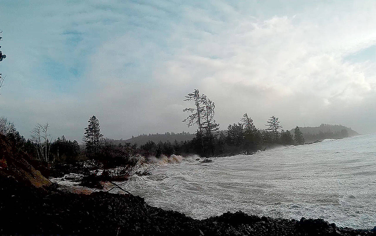
PHOTO COURTESY OF CONNIE ALLEN The North Cove shoreline south and east of Seamobile Drive, near the end of Old State Route 105, had been fortified in the days leading up to the high surf whipped up by 60 mph wind gusts and aided by king tides, preventing any major loss of land.
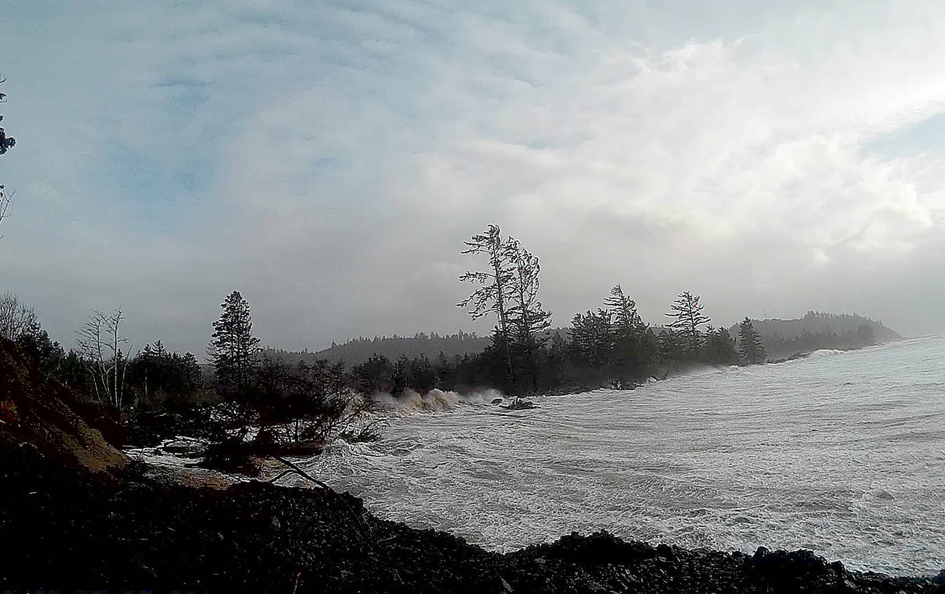
PHOTO COURTESY OF CONNIE ALLEN The North Cove shoreline south and east of Seamobile Drive, near the end of Old State Route 105, had been fortified in the days leading up to the high surf whipped up by 60 mph wind gusts and aided by king tides, preventing any major loss of land.